
Elevate
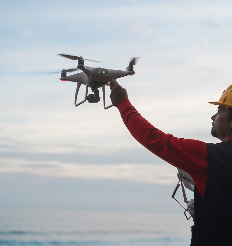
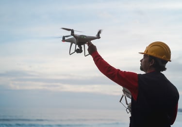
Aerial and ground photography, video, and reality capture for real estate, construction, marketing, and public safety support.
Heightened Senses delivers professional visuals and reality capture across Eastern North Carolina and beyond.
If you need crisp marketing imagery, repeatable progress documentation, or clear situational awareness content, we bring a disciplined workflow, safety first flight ops, and clean deliverables that are easy to use.
At Heightened Senses, we provide a diverse range of professional photography, videography, and aerial imaging solutions designed to elevate your vision and deliver precision-driven results.
📸 Photography
Ground based and aerial photography for real estate listings, commercial marketing, events, lifestyle, landscapes, and branded content. Expect sharp composition, true to life color, and consistent results.
🎥 Videography & Cinematography
Ground and aerial video designed for storytelling and marketing impact. Short form social clips, property walk throughs, highlight reels, and cinematic sequences with professional editing available.
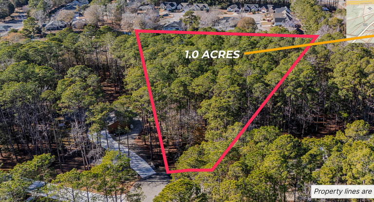
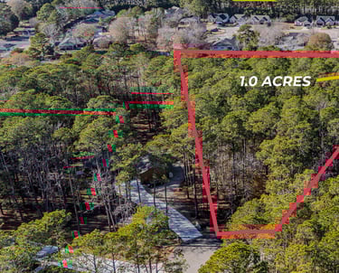
🗺️ 2D Orthomosaic Mapping
High resolution orthomosaic style map products for visualization, documentation, progress tracking, and planning support. These deliverables are not intended for legal boundary work or land surveying.
🏗️ 3D Modeling & Digital Twins
Step into the world of immersive 3D visualization. We generate highly detailed 3D models for real estate, construction, architecture, and industrial applications, offering unparalleled accuracy for planning, design, and analysis.
📐 Engineering & Architectural Design Support
Enhance precision and efficiency with our data-driven design support. We collaborate with engineers, architects, and urban planners to provide detailed site scans, elevation models, and project insights, ensuring optimal planning and execution.
🌱 Agricultural Scanning & Land Analysis
Leverage advanced aerial scanning for precision agriculture, crop health monitoring, and land management. Our multispectral imaging provides actionable data to optimize yields, improve sustainability, and make informed, data-driven farming decisions.
Our Services

Featured
Videography
Ground and aerial video, edited for marketing and storytelling.
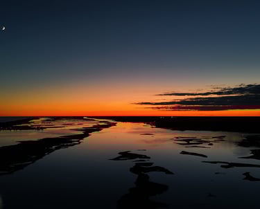
Aerial Real Estate Photography
Aerial real estate photography can help a realtor showcase properties in their best light by providing stunning views highlighting unique features and the surrounding area, ultimately attracting more potential buyers.
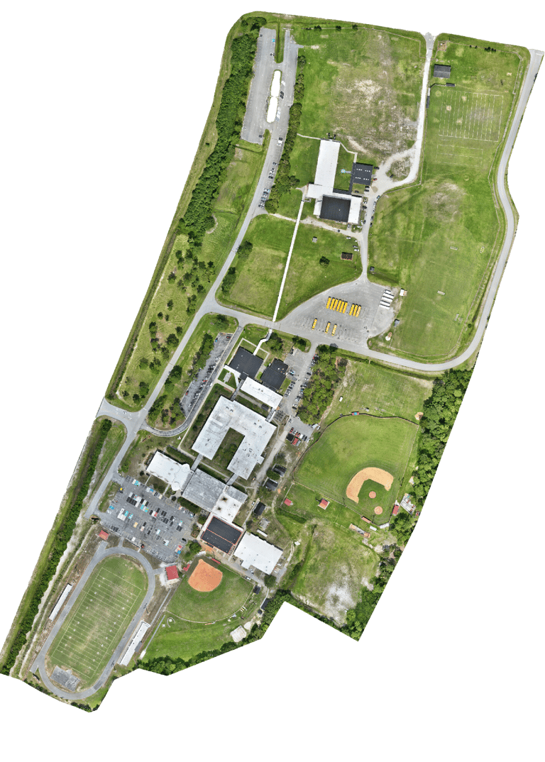
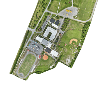
Mapping
Creating detailed maps with high accuracy for various applications.
Enhancing architectural and engineering designs with 3D modeling.
3D Models
About Us
Heightened Senses is built on safety, precision, and professionalism. We operate under FAA Part 107 and follow best practices for risk management on every job. We are insured and we show up prepared, communicate clearly, and deliver on time.
Important note on mapping
We do not provide licensed land surveying or boundary determination services. Mapping and modeling outputs are produced for visualization, documentation, and planning support. If a project requires licensed survey or engineering deliverables, we can support your team under the direction of the appropriate licensed professional.


At Heightened Senses, we are committed to delivering outstanding results that exceed your expectations. Our innovative approach, attention to detail, and commitment to excellence set us apart. Whether you are planning an event, developing a project, or seeking technical solutions, we are your trusted partner to enhance your vision.
Elevate your senses with Heightened Senses – Where Creativity meets Precision.
Contact Us
📍 Based in Sneads Ferry, NC
We proudly serve clients throughout Eastern North Carolina, including:
🌊 Wilmington, Wrightsville Beach, Hampstead, Holly Ridge, Surf City, and Topsail
🏡 Jacksonville, Swansboro, Emerald Isle, and Atlantic Beach
📍 New Bern, Morehead City, and surrounding areas
We’re also equipped to travel beyond Eastern North Carolina for special projects. If you're interested in working with us, reach out today—we’re ready to bring your vision to life!
Ready to take your projects to new heights? Contact us now to discuss how our aerial services can elevate your vision.